Shaowen Wang to Deliver the 2019 Borchert Lecture
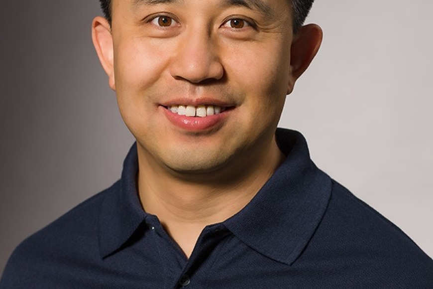
We are excited to announce that Shaowen Wang is the 2019 John R. Borchert Lecture speaker. Dr. Wang is Professor and Head of the Department of Geography and Geographic Information Science at the University of Illinois at Urbana-Champaign (UIUC). He has served as Founding Director of the CyberGIS Center for Advanced Digital and Spatial Studies at UIUC since 2013. Dr. Wang received a B.S. in Computer Engineering from Tianjin University, a M.S. in Geography from Peking University, and a Master of Computer Science and a Ph.D. in Geography from the University of Iowa.
His research interests include geographic information science and systems (GIS), advanced cyberinfrastructure and cyberGIS, complex environmental and geospatial problems, computational and data sciences, high-performance and distributed computing, and spatial analysis and modeling. His research has been actively supported by a number of U.S. government agencies and industry. He has served as the principal investigator of several multi-institution projects sponsored by the National Science Foundation (NSF) for establishing the interdisciplinary field of cyberGIS and advancing related scientific problem solving in various domains (e.g., agriculture, bioenergy, emergency management, geography and spatial sciences, geosciences, and public health). He has published 100+ peer-reviewed papers including articles in 30+ journals.
Dr. Wang served as Associate Director of the National Center for Supercomputing Applications (NCSA) for CyberGIS from 2010 to 2017 and Lead of NCSA’s Earth and Environment Theme from 2014 to 2017. He has served as an action editor of GeoInformatica, associate editor of SoftwareX, and guest editor or editorial board member for multiple other journals, book series, and proceedings. He served on the University Consortium for Geographic Information Science’s (UCGIS) board of directors from 2009 to 2012 and President of UCGIS from 2016 to 2017. Additionally, he served on the advisory board of the NSF Extreme Science and Engineering Discovery Environment (XSEDE) program from 2016 to 2018, and as a member of the Board on Earth Sciences and Resources of the National Academies of Sciences, Engineering, and Medicine since 2015.
His Borchert Lecture is titled, Geospatial Discovery and Innovation in the Era of Artificial Intelligence and CyberGIS. CyberGIS represents an interdisciplinary field combining advanced computing and cyberinfrastructure, geographic information science and systems (GIS), spatial analysis and modeling, and a number of geospatial domains (e.g., emergency management, smart cities, and the nexus of food, energy, and water systems) to enable broad research and education advances. It has also emerged as new-generation GIS based on holistic integration of high-performance and distributed computing, data-driven knowledge discovery, visualization and visual analytics, and collaborative problem-solving capabilities. The growing importance of cyberGIS is reflected by increasing calls for solutions to bridge the significant digital divide between advanced cyberinfrastructure and geospatial communities in the era of artificial Intelligence. This talk discusses challenges and opportunities for artificial Intelligence and cyberGIS to transform geospatial discovery and innovation through interdisciplinary and transdisciplinary approaches.