Carl Steinitz gave the 14th Annual Borchert Lecture as part of the 2020 Virtual UMN Spatial Forum
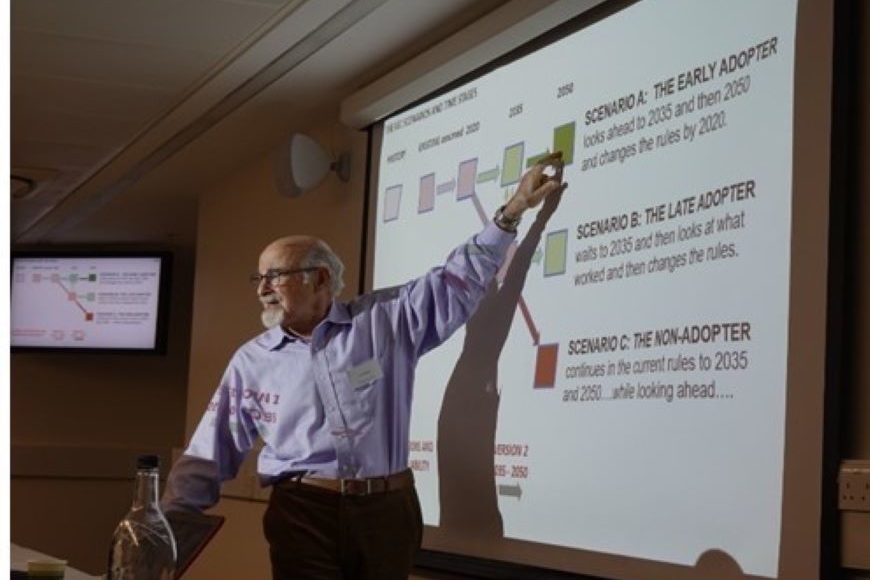
Dr. Carl Steinitz gave the 14th annual John Borchert Lecture titled, “Re-thinking the Growth of London: An interactive multi-stakeholder perspective derived in geodesign and negotiation” to almost 400 participants as part of the 2020 Virtual UMN Spatial Forum. Dr. Carl Steinitz is the Alexander and Victoria Wiley Professor of Landscape Architecture and Planning Emeritus at Harvard Graduate School of Design, and Honorary Professor at the Centre for Advanced Spatial Analysis, University College London.
This lecture series honors the late John Borchert, University of Minnesota Regents Professor in the Department of Geography, Environment & Society, and member of the US National Academy of Science. Each year, members of the Borchert family attend the event and this year we were honored to have Dave, Patricia, Bill, Michael, and Tom Borchert join the event.
Dr. Steinitz began his affiliation with the Harvard Laboratory for Computer Graphics and Spatial Analysis in 1965. In 1967, Professor Steinitz received his PhD degree in City and Regional Planning, with a major in urban design, from the Massachusetts Institute of Technology (MIT). In 1984, the Council of Educators in Landscape Architecture (CELA) presented Professor Steinitz with the Outstanding Educator Award for his “extraordinary contribution to environmental design education” and for his “pioneering exploration in the use of computer technology in landscape planning”. He has been honored as one of Harvard University’s outstanding teachers.
Professor Steinitz is the principal author of Alternative Futures for Changing Landscapes, Island Press, 2003, and author of A Framework for Geodesign, Esri Press, 2012. He has lectured and given workshops at more than 150 universities and has several honorary degrees. He is co-coordinator of the International Geodesign Collaboration, which he discussed in the Borchert lecture and provided a case study involving the future growth of London.
The UMN Spatial Forum is an annual event sponsored by the Department of Geography, Environment and Society, the MGIS program, U-Spatial and DASH. Please be sure to join us next year!